Jump To Course
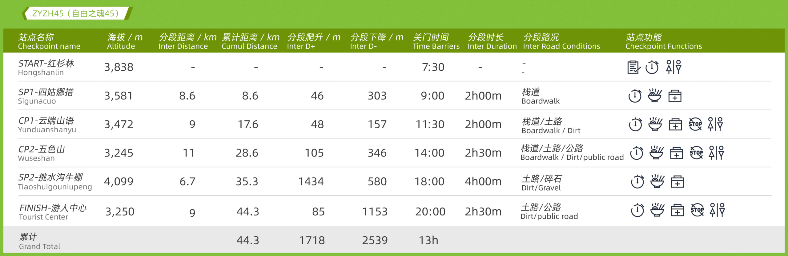
km
DISTANCE
m
ASCEND
m
DESCEND
PEAKS
CHECKPOINTS
h
CUTOFF
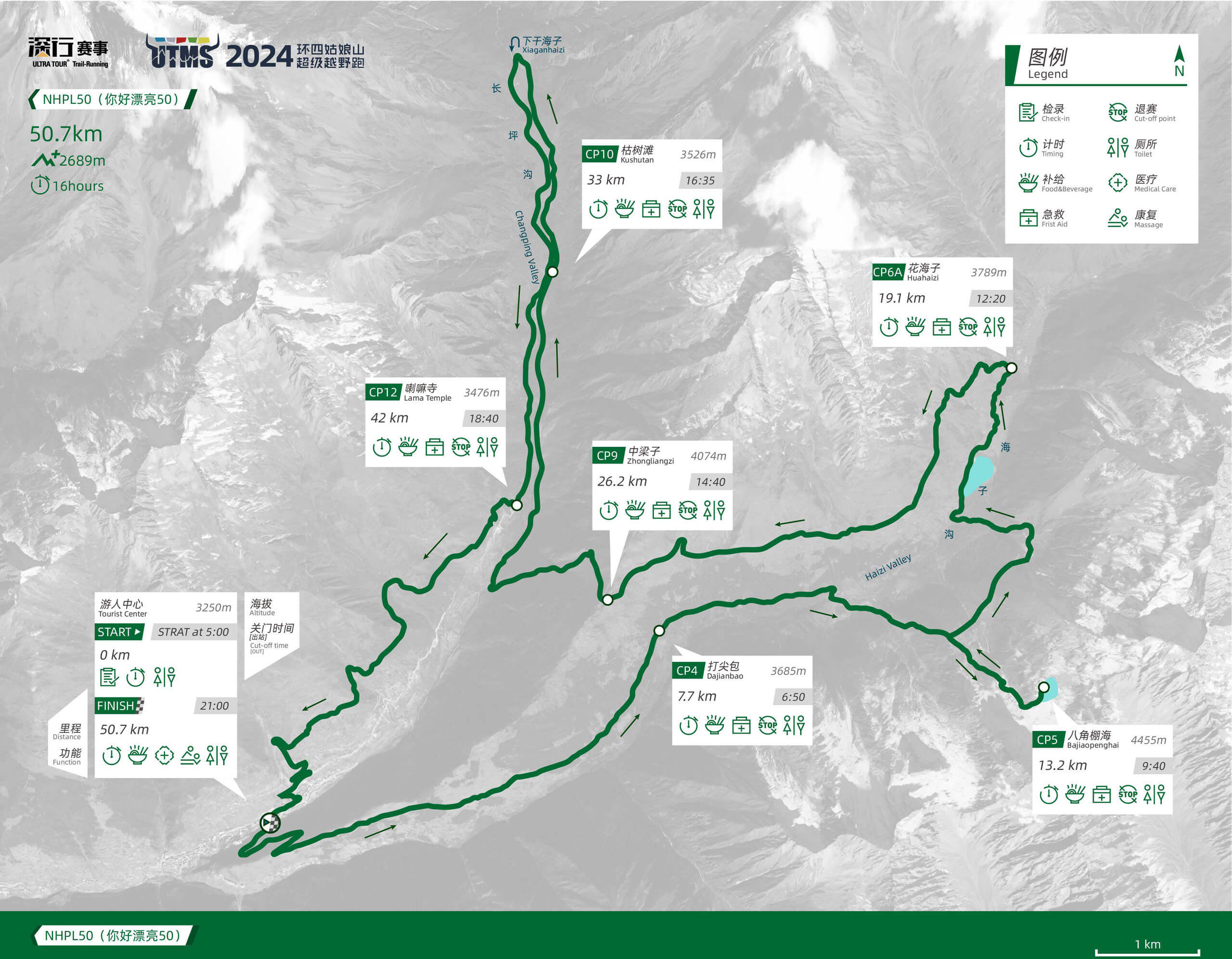
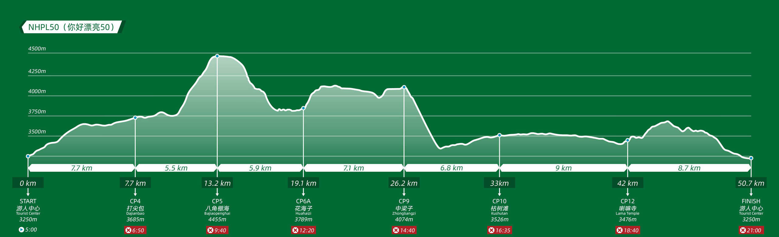
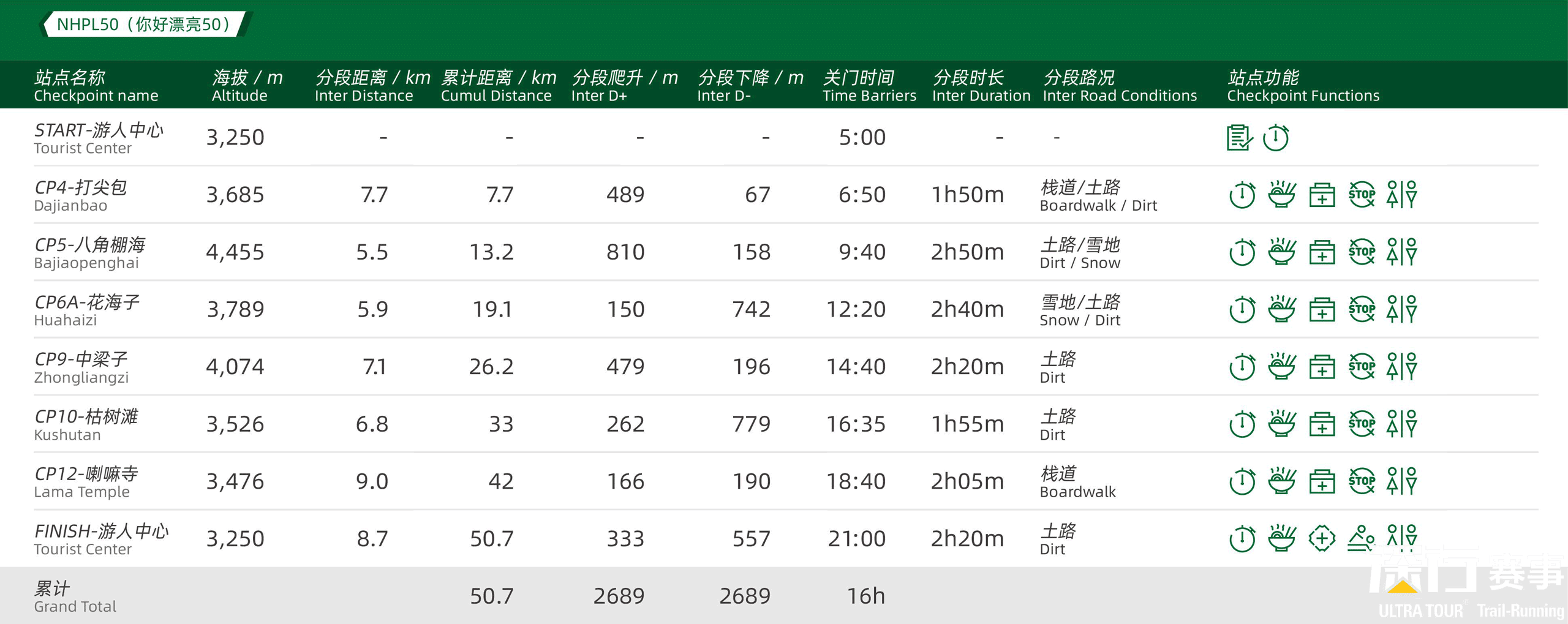
km
DISTANCE
m
ASCEND
m
DESCEND
PEAKS
CHECKPOINTS
h
CUTOFF
km
DISTANCE
m
ASCEND
m
DESCEND
PEAKS
CHECKPOINTS
h
CUTOFF
km
DISTANCE
m
ASCEND
m
DESCEND
PEAKS
CHECKPOINTS
h
CUTOFF
km
DISTANCE
m
ASCEND
m
DESCEND
PEAKS
CHECKPOINTS
h
CUTOFF